
Welcome to the Hickory Flat Area Plan
We’ve received lots of helpful feedback from the community and are currently making significant edits to the draft plan document. Once complete, we will repost the whole document here for public review. In the meantime, we have provided an overview presentation plus the draft Future Land Use Plan and the Trails and Roads Plan for review and comment.
Below are two links for the Hickory Flat Area Plan. The first one is our June 6th Draft Plan. The second is a Plan Highlights Presentation that provides an overview of the plan and places the maps below into context.
June 6th Draft Plan
Plan Highlights Presentation Link
Please give us feedback through the form at the bottom of the page.
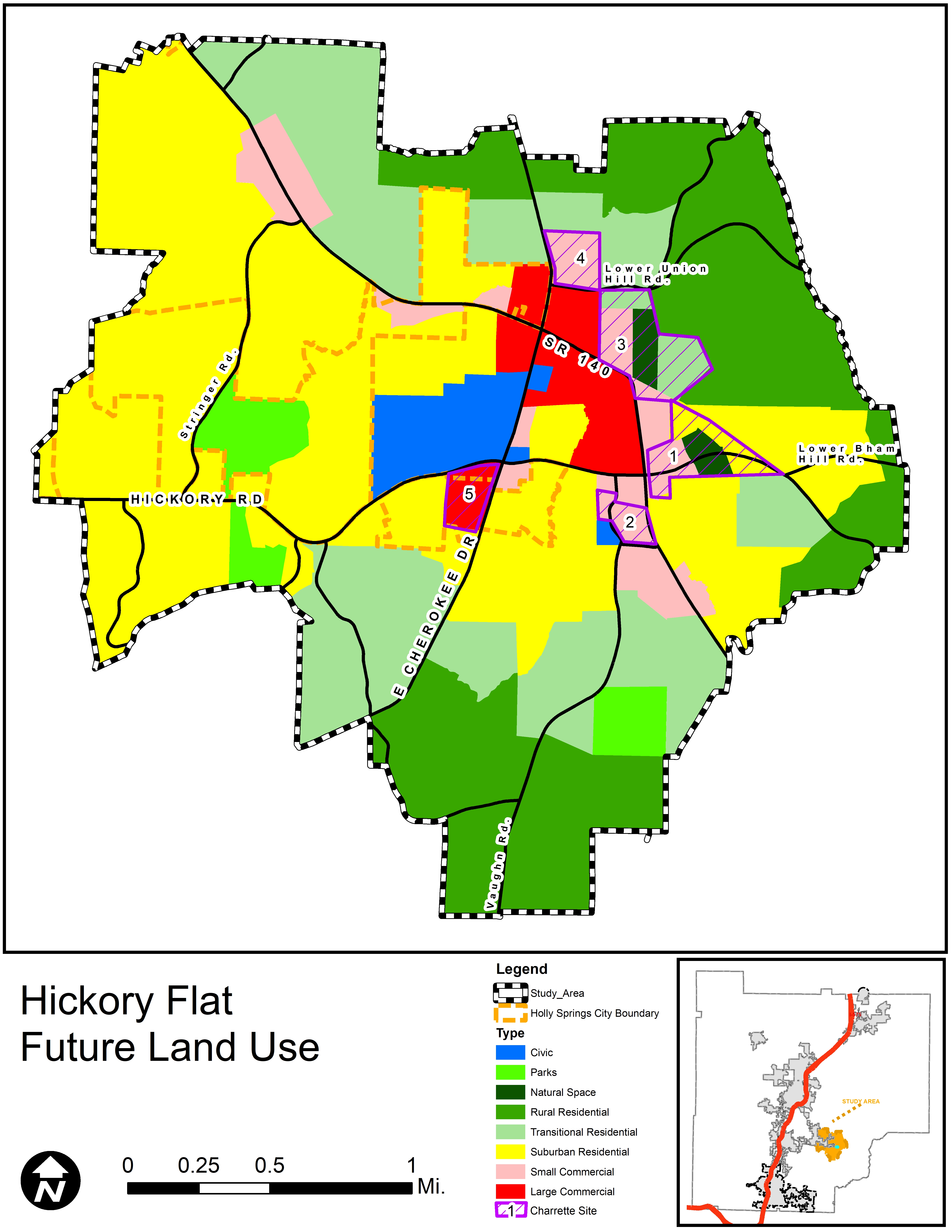
Future Land Use Plan
The Future Land Use Map was created using the feedback that was given by the public throughout the planning process, notably the responses from both charrette opportunities, along with the knowledge of what is currently developed and zoned. Adjustments were made to areas outside off the five charrette sites based on adjacent existing land uses and transportation connectivity.
On these maps, the land uses shown within the five charrette sites are not meant to serve as the exact locations for these, but are representative of the Community’s vision as expressed in the charrette process. Master plans for each site are strongly encouraged before development to ensure the vision of the community is properly fulfilled.
Click HERE for land use descriptions.
Click on the map for a larger version.
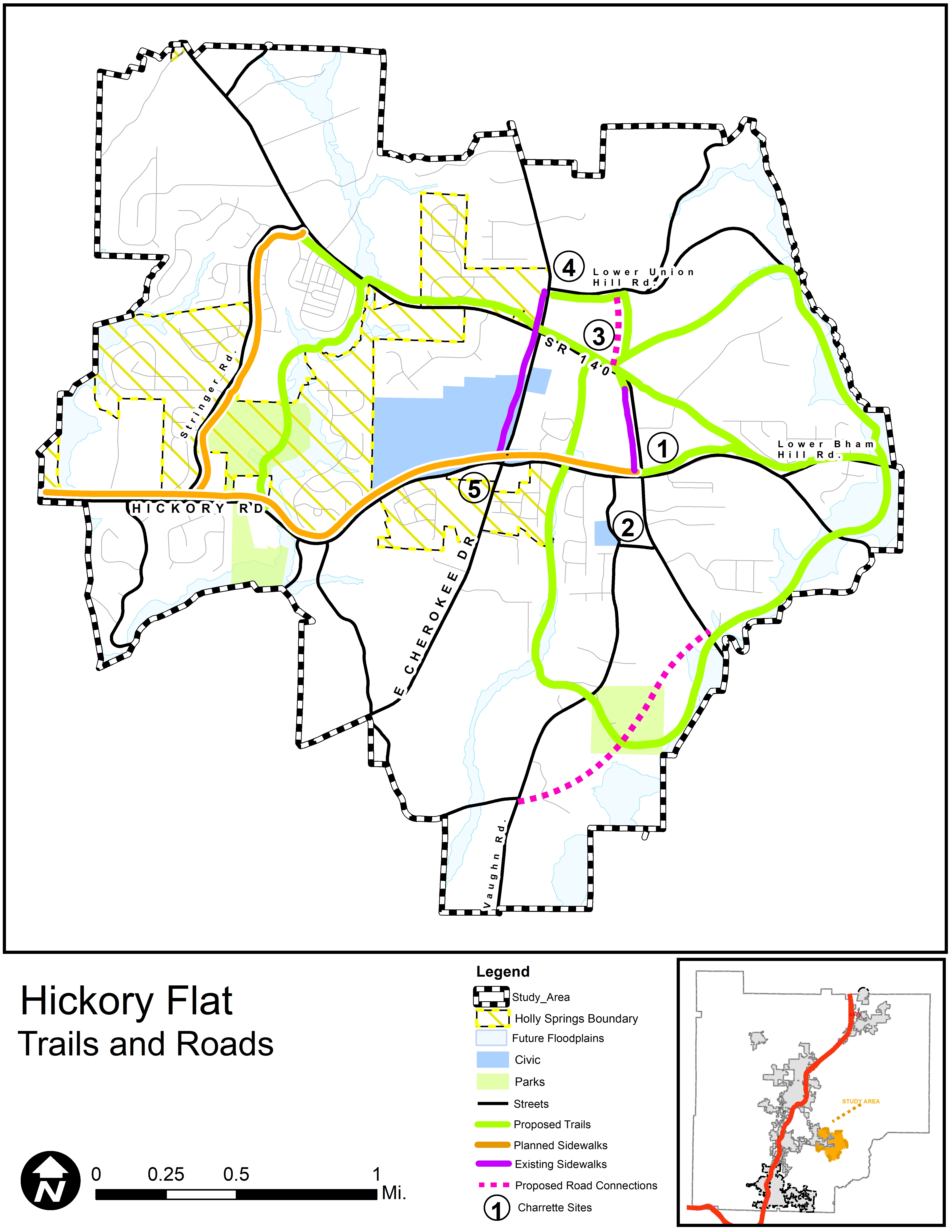
Trails and Roads Plan
The Trails and Roads Plan was also created with public input about the core of the community and then expanded to a complete network using already planned pedestrian improvements, undevelopable stream corridors and floodways, and road right-of-way. Proposed road connections are shown linking State Route 140 to Lower Union Hill Road, through Charrette Site #3, and an extension of Little Road to State Route 140. All lines are drawn conceptually with no planned alignment.
Click on the map for a larger version.
To provide comments, please fill out the form below or see the “About” Page for more information.